Monitoring of Oil and Gas Infrastructure
Extraction companies, gas pipeline operators, and product pipeline operators continuously monitor the condition of their extraction and transportation infrastructure, thereby reducing technological risks and risks of unlawful acts by third parties.
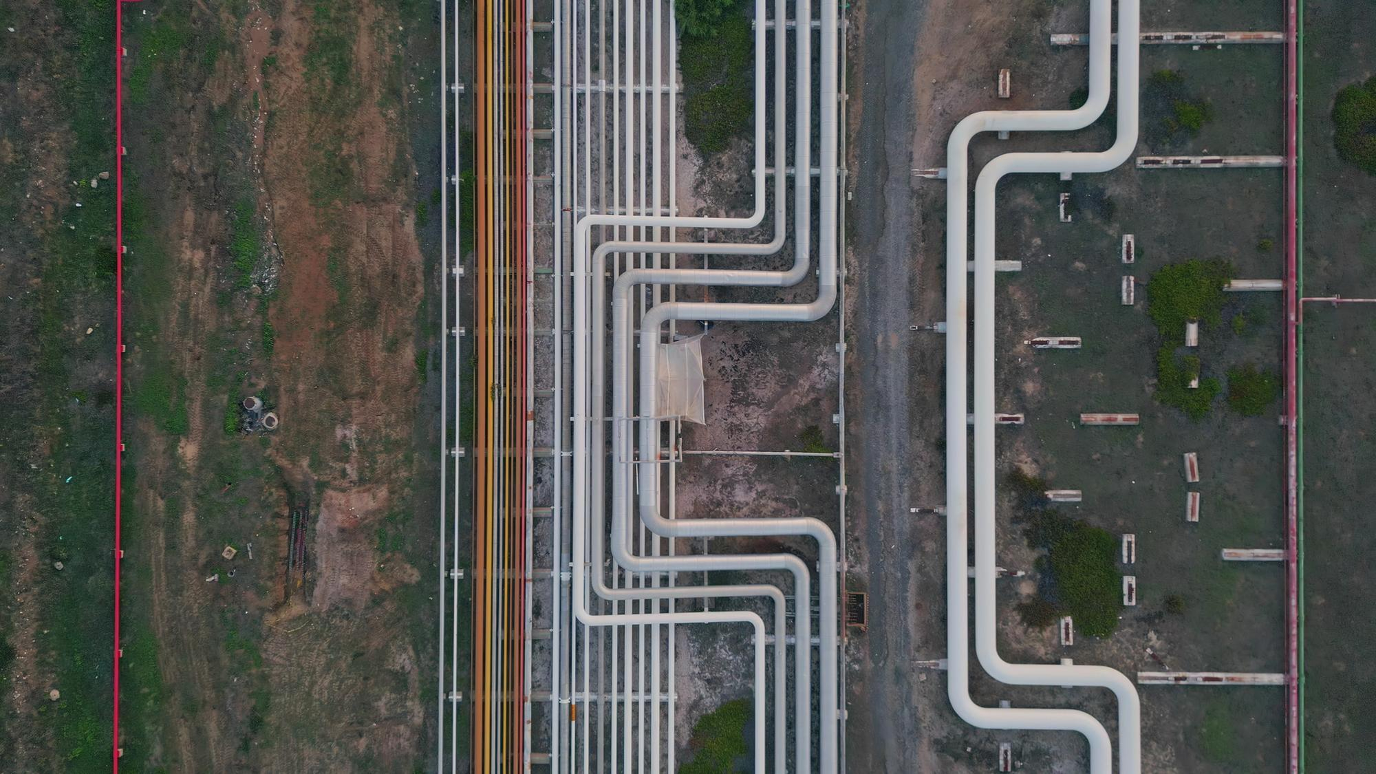
Such measures require monitoring of hundreds, or even thousands, of kilometers of main pipelines and high-pressure local pipelines, oil depots and reservoirs, compressor stations, terminals, and more.
Traditionally, monitoring was conducted with the involvement of a large number of ground control teams, while monitoring over long distances relied on piloted aviation. However, with the development of unmanned aviation systems and geographic information system (GIS) software solutions, monitoring has become more technologically advanced, higher in quality, and economically attractive. According to several expert assessments, the simultaneous use of unmanned aerial vehicles (UAVs) and GIS ensures savings of around 30% of the infrastructure monitoring budget.
The simultaneous use of UAVs and geographic information systems ensures approximately a 30% budget saving on infrastructure monitoring.
We developed Irizi Scale based on the requirements of one of the longest and most extensive gas transportation networks globally. Validation of the implemented functionality occurred through regular monitoring of a large segment of the gas transportation system using Irizi Scale, Abris unmanned systems, and with the participation of experienced flight crews from DEF-C company.
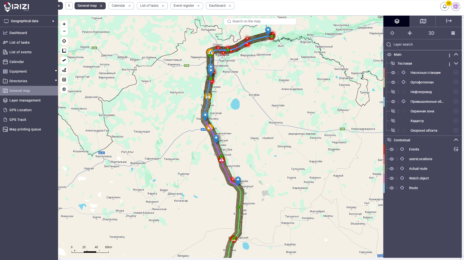
Today, the construction of a monitoring center based on Irizi Scale and other elements of the Irizi ecosystem will provide the operator of oil and gas extraction and transportation infrastructure with the ability to implement such use cases:
- Mapping all infrastructure requiring monitoring.
- Dividing the infrastructure into separate fragments of the overall distance and creating monitoring objects from them.
- Creating a schedule of monitoring missions – tasks and allocation of resources for their implementation – teams and equipment.
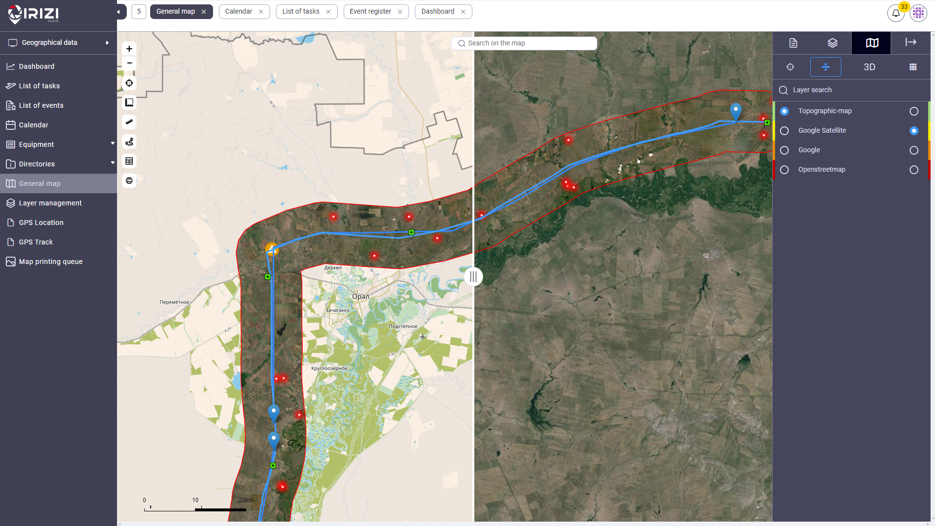
- Aerial photography of the protective zone of the gas pipeline, creating an orthophoto map, and placing it on the map for visualization of the current state of the territory.
- Regular monitoring of the protective zone of the gas pipeline using UAVs.
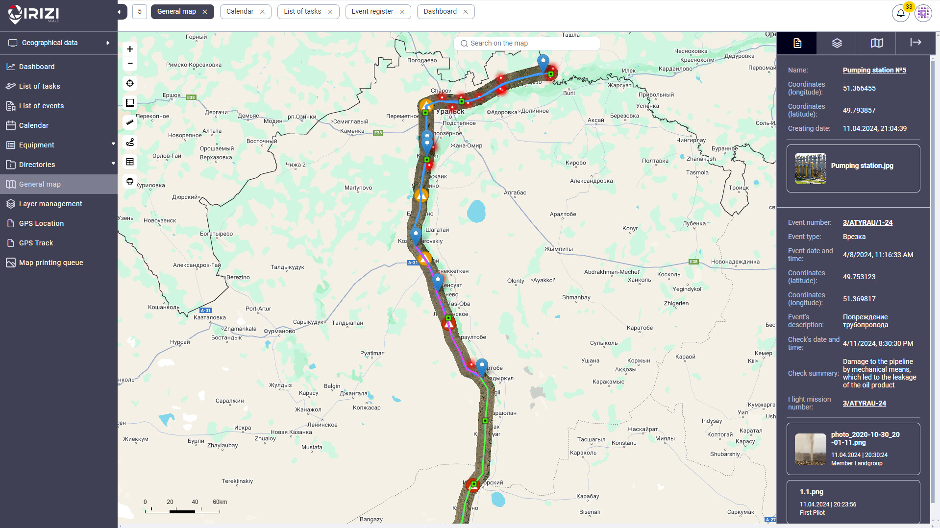
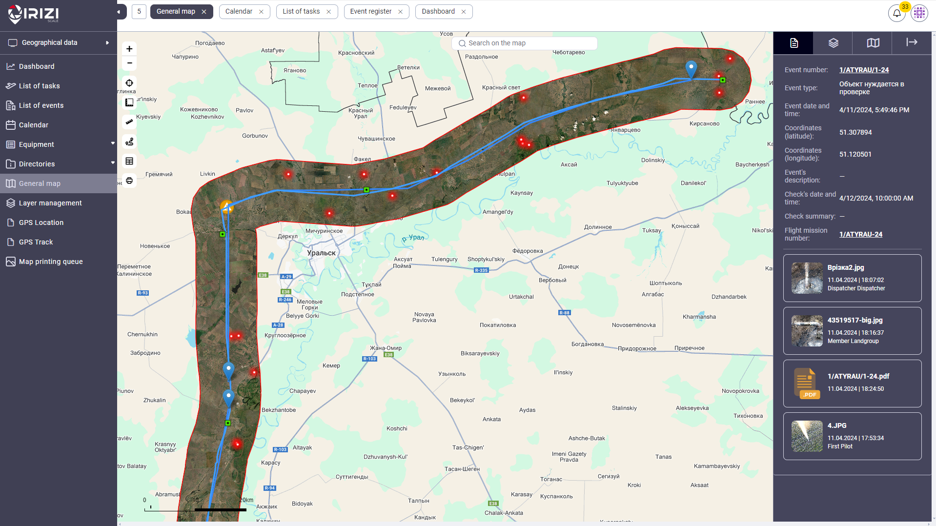
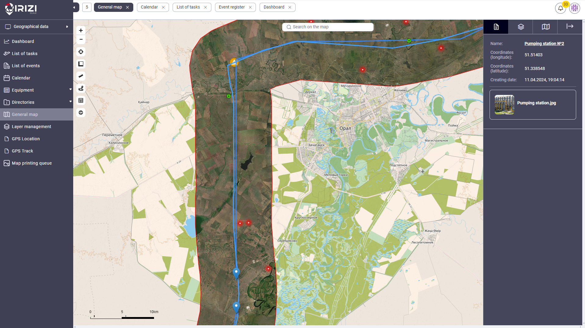
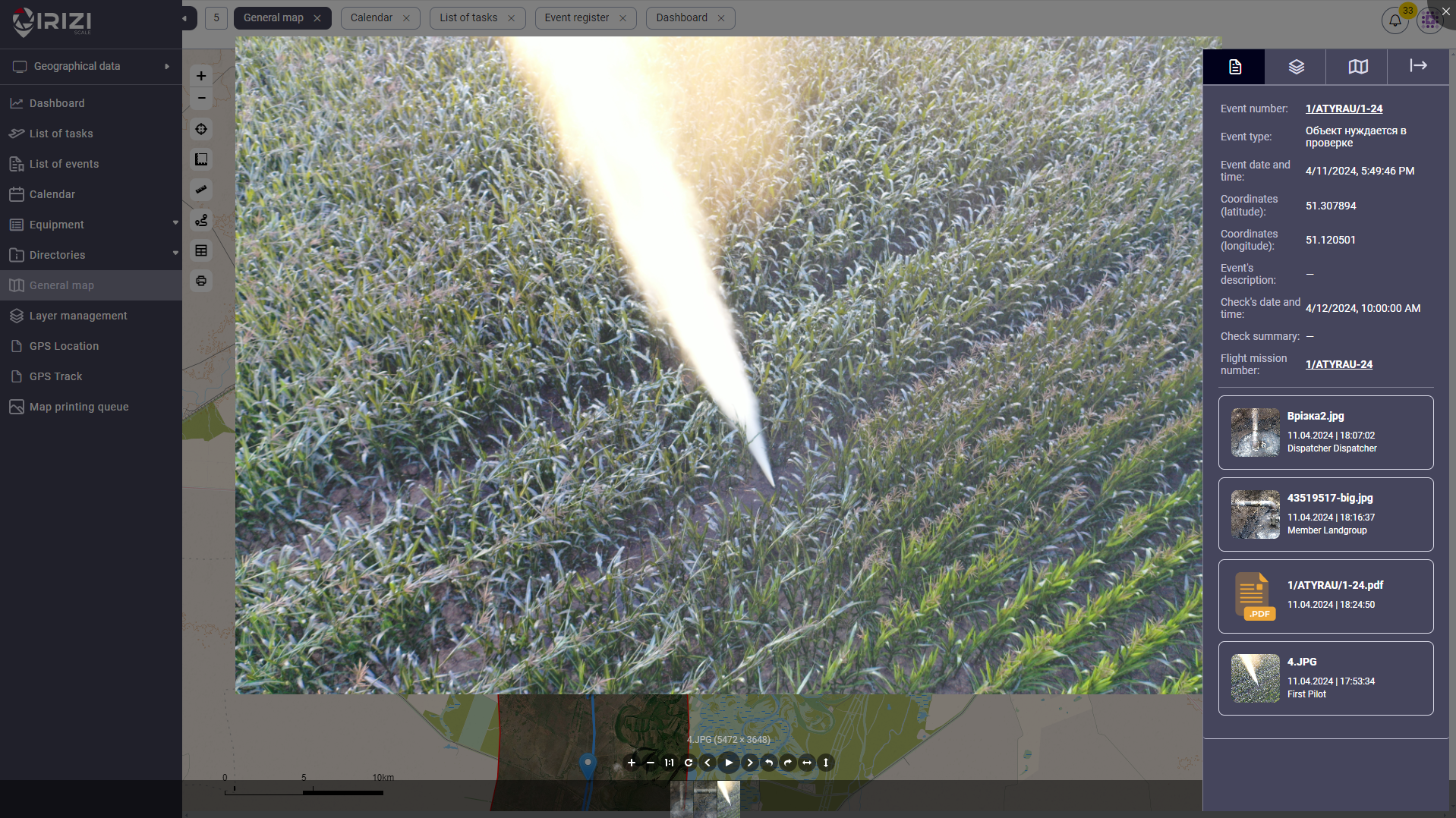
- Prompt mapping and user access to detected events with geographic coordinates, type, and importance category.
- Prompt mapping and user access to objects with geographic coordinates, type, and specific designation from the loaded library of symbols.
- Adding files illustrating and documenting events and objects on the map.
- Video broadcasting from UAV cameras to the task interface being executed.
- Displaying all active video streams on the video wall in the situation room or dispatch center.
- Automatic collection and storage of UAV and equipment operation data and control of maintenance cycles.
- Aggregation of research data, data attribution, and automatic report generation.
According to the requirements of the pipeline operator company, we adapted the role matrix by creating 8 roles, ensuring coverage of the main business processes of monitoring activities and interaction among users of the entire functional structure of the company.
It is worth noting the business process of the “Event Lifecycle.” In accordance with the practices of the pipeline operator company, we created 5 categories of geo-related events in the system. Category 5 represents the least critical event, while Category 1 requires immediate response and resolution of consequences within 2 hours.
As a part of the automated business process, functionality has been developed to ensure quick escalation of newly added Category 1 events to the regional or main dispatcher level, event validation, transfer of the event as a task to the security service of the respective region, and further assignment to the relevant ground monitoring team.
An event that requires the quickest response and urgent consequences resolution is rapidly added to the system and almost instantly forwarded to the dispatcher.
Irizi Scale offers a wide range of tools to ensure operational transparency. Entity and data connectivity, event logging in the system, the use of digital signatures, and tools like Active Directory provide capabilities for generating reports on current activities and working with historical data. An examples of this are:
- Automatic generation of reports for current projects,
- Compliance reports, and documentation of operations.
- Investigation of incidents related to conducted research.
- Signing of documents by project participants and their transmission to external systems.